Topographic Surveys
What You Need to Know About Topographic Surveys
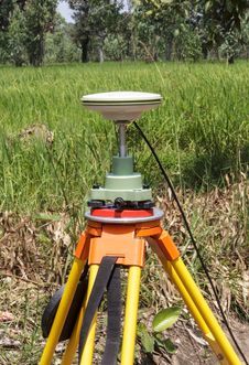
What is a Topographic Survey?
A topographic survey will show the height, depth, size and location of any improvements or natural characteristics on the subject parcel of land. A topographical survey will also focus on the changing elevation throughout the subject land plot. As much as boundary surveys primarily feature horizontal measurements, topographic surveys look primarily at elevation.
On a topographic survey you will see a parcel of land’s topographical information. This includes contours and elevations of the land as described in reference documents like the deed. The changes in elevation are shown on the topographical drawing as “contour lines.” The surveys will also convey information on natural as well as man-built features on the land, which is especially useful for those who intend to purchase and then develop the land, as it provides detailed information on where different features are located.
Features typically shown on a topographic survey map include slopes, trees, and changes in elevation, streams and rivers, streets and walkways, buildings, fences and walls, manholes, utility poles, and more. This visual information is used by engineers, architects, and construction contractors to design and plan for the construction of land improvements.
Get a free quote
Contact Us